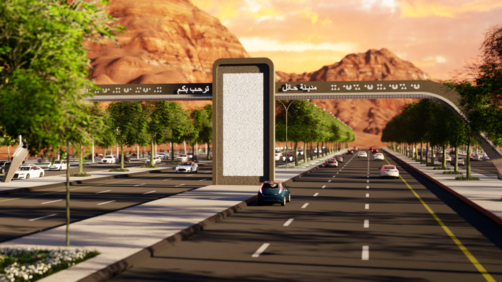
نستخدم تقنيات هندسية حديثة وحلول مبتكرة لتصميم بنية تحتية تلبي متطلبات النقل الحديثة من ناحية أعطاء الأولوية للسلامة المرورية وزيادة الكفاءة والاستدامة.
للتواصل
الخدمات
- جمع البيانات والمسح الطبوغرافي
- دراسات الجدوى
- التصميم التصوري
- التصميم الأولي
- التصميم التفصيلي
- الهندسة القيمية
- جدول الكميات
- تقييم العروض والمناقصات
Surveying Equipment
The company owns modern equipment, which facilitates the completion of field survey work in a short period of time and with high accuracy.
-
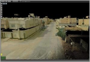
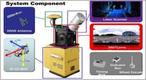
( LIDAR – Mobile Mapping System ) Topcon IP – S3
Mobile mapping systems are powerful tools that enhance the efficiency and accuracy of geospatial data collection and analysis. Their functions extend across various fields, including urban planning, surveying, transportation, and environmental monitoring, making them invaluable for modern mapping and data management.
-
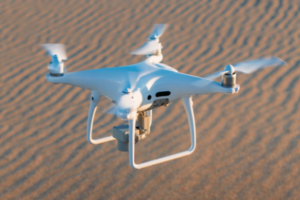
(Drone – RTK / PPK / VRS) EBee Plus
Drones are powerful tools to help in the mapping and surveying industry. They can effectively perform work for 3D mapping, land survey, photogrammetry, and topographic surveying by flying above the ground
-
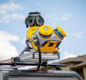
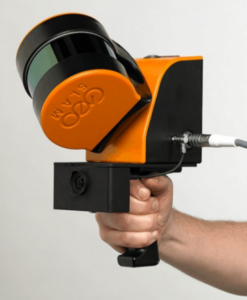
( Handheld 3D Laser Scanner ) ZEB HORIZON
Capture accurate 3D data of complex shapes, surfaces, and structures.
-
(GNSS Receivers) leica
GNSS receivers play a vital role in navigation, positioning, timing, and data collection across various industries
-
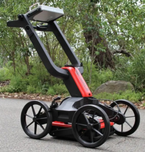
(GPR) MALÅ Easy Locator series
GPR is a versatile tool that offers non-destructive, high-resolution imaging of the subsurface. Its applications span various fields, including construction, archaeology, environmental monitoring, and forensic investigations, making it an invaluable technology for subsurface analysis.